Greetings folks,
In accordance to my status as an employee at Meridian, I do need to be a little careful at what I say and write about on the blog here regarding the flood forecasts. So, first off, I want to apologize for anyone coming here to find any kind of forecast from me. All I will provide from here on out will be only be opinions and/or criticisms. The latter, only if need be, of course! Hah!
Anyhow, I figured I would provide a link to the official forecasts from the North Central River Forecast Center for the East Grand Forks, MN forecast point on the Red River:
http://www.crh.noaa.gov/ahps2/hydrograph.php?wfo=fgf&gage=egfm5&view=1,1,1,1,1,1,1,1&toggles=10,7,8,2,9,15,6
From this first page, you can view the current stage of the river, as well as, historical crests and impacts at various stages of the river, if you scroll down the page.
If you click on the "Chance of Exceeding Levels During Entire Period" tab at the top, it will bring up a graph of the forecast crests the NCRFC is forecasting and the probabilities for each during the period. The 50-60 percentile is basically the threshold for concern, since at this point, we're looking at a fairly respectable chance of seeing a crest at that stage.
As you may see, the 50-60 percentile falls very near a 50 foot crest. Which would make it the 2nd or 3rd highest crest on record. Obviously, this highly depends on weather conditions over the next couple of weeks. If we would happen to get additional precipitation, for instance, significant changes could occur to these numbers.
Again, for interests in the Valley, please keep this link handy - and check up on it, at least every other day or so. Especially, over the course of the next week, as warmer temperatures expected to push in will quickly melt our snow-cover.
This will continue the wet, slushy mess out there on the roads during the day and refreezing issues at night.
NCRFC Forecast
Record flooding?
Hello folks,
It's been a little while since I wrote last, and considering I've been out celebrating a co-worker's birthday this evening and the fact I have to be up in 5-4 hours for work, I will keep this rather short.
For those of you here in the Red River Valley, you may want to seriously consider checking into flood insurance, especially if you live within the first 5 miles of the Red River. The reason?
The NWSFO out of Grand Forks released their latest forecast just yesterday for the Red River Valley, and many locations along the river may see major flooding by mid-April.
In fact, here are the probabilities that river stages could exceed the record 1997 stages:
http://www.crh.noaa.gov/news/display_cmsstory.php?wfo=fgf&storyid=23149&source=0
It's pretty clear that many locations along the Red River will see near to close to record stages by early-mid April.
This could potentially lead to catastrophic flooding for the Red River valley, including the Grand Forks area. We'll have to see how much more snow (or rain, for that matter) occurs here in the local area to see exactly how bad things may get. Until then, keep updated!
I'll try to keep abreast of any significant changes to the forecasts and will pass these along.
Edit: 03.15.2009 @ 11:18 PM CST
Chasing as a Rite of Passage
I had to share a story the other day and thought it deserved to be featured here as well... If you have ever found yourself wondering just how important storm chasing really is to someone like myself, read on...
I've received the questions many, many times before. "You do what? Are you crazy?" These questions were among many other variations. I’ve taken them in stride and through a dialog, in many cases, most people I find, are more intrigued in the activity than are scared. Storm chasing has been a hobby of mine since 1994; a year after I had received my driver's license. By late that summer, I was already driving about and watching storms all across my hometown and within the county.
When I first started out, it was purely the thrill I was after. I had held an acute interest for severe weather for such a period of time; I wanted to learn by experience and association. Unfortunately, my parents didn't share the enthusiasm I had. As a result, they only allowed for me to remain close to home and always wanted to know where I'd be and for how long they could expect me to be gone. How do you answer your parents when they ask such a thing? I would typically answer, "Where the storms are... and for as long as they're shooting out lightning, heavy rain, hail, or whichever!" They were not always content with those answers.
As my chase career advanced, my Meteorological aptness did, as well. By the time I was a senior in High School, I had already read every single book I could get my hands on, that had anything to do with Meteorology. I participated in local Skywarn training offered from the National Weather Service to become a spotter for the county and eventually was able to network with veteran chasers all across the Internet. I absorbed as much information from them as I was able to. I asked them questions when I didn't understand something and they were always more than willing to help. Eventually, I was able to give more sufficient answers to my parents. As a result, they finally saw chasing as my passion and allowed me to explore further. With a different motive now, however, I took to spotting and chasing more seriously. I approached chasing in a safer way and the experience itself, became more than a "thrill." It became something meaningful not only physically, but emotionally.
Today, I still perceive storm chasing in the same regard. It no longer primarily serves as a reason to drive a hundred miles for a thrill. Although the adrenaline rush is unquestionably a component, chasing provides an opportunity for me to connect to nature, to enjoy her beauty, and to reminisce with the person I really am. There often is plenty of time for that! Storm chasing has become a rite of passage for me. It serves as a time to get away from the bustle of the city, all the responsibilities that come with living independently, and the complexities of life. Being out on a secluded, dusty road, waiting for a storm to develop or evolve is very relaxing and simplistic for me. It's rewarding, as well, when you get to see something as transparent as the atmosphere, transform into powerful thunderstorms.
Severe Weather Outbreak
Well, folks, it appears the convective severe season has begun across the Southern Plains and Southern Mississippi Valley. Numerous reports of hail, damaging winds, and tornadoes have sprung up across the region today.
A combination of several factors are resulting in the outbreak... First, a deep trough over the west, resulting in strong west-southwest flow aloft (700 mb flow of 100+ KTS is providing for 50+ KTS of bulk shear over areas of Eastern Texas, Eastern Oklahoma and western areas of Arkansas and northwest Louisiana). Second, a potent shortwave being kicked eastward out of the southwest by the trough... Third, southerly winds at the surface. Finally, warm and juicy air advecting northward out of the Gulf. It's a darn good synoptic setup for an outbreak of this magnitude.
The setup will push eastward overnight and into tomorrow, so additional severe weather is in store for areas over the Tennessee Valley and into the Lower Ohio Valley, Wednesday. It will be an active week with this system pushing through the eastern US, while another shortwave trough will eject into the Southern Plains from the the cut-off low over the southwest.
This type of pattern would spell a chaser's dream in May or June, let alone in mid-February.
While I'm jealous of the chasers in the Southern Plains, I don't necessarily want to see damage or fatalities. Luckily, there have been no reports of fatilities or injuries, but there have been widespread damage reports. Edmund, Olkahoma seems to be hardest hit, as far as tornado damage is concerned. Reports are trickling in now, that northwestern areas of the city saw major damage from a large tornado there earlier this afternoon. I haven't confirmed this, myself, but either way, I'm hoping folks there took the proper precautions and are doing well.
I've been watching areas down there most of the afternoon and into the evening and, as you can see on the Radar Floater, a strong squall line is currently pushing eastward across Texas and Oklahoma late tonight. This will likely continue to bring damaging winds, hail, and possibly an isolated tornado or two.
Major ice storm in progress...
Moderate to heavy snows and on-going freezing rain and sleet continue to fall over the Lower Ohio Valley early this morning. While the snowfall is significant, the amount of icing is most impressive with this large system pushing east-northeast. The latest radar from Indianapolis (to the right) clearly shows the enhanced reflectivities with the freezing rain and sleet over southern and eastern Indiana.
The higher reflectivities result from two processes... First, from the radar beam reflecting off frozen precipitation particles. Secondly, from the radar beam being reflected off melting nuclei (ice particles melting at the point where ice pellets aloft are entering the shallow warm-layer between roughly 850 and 800 mb. RUC forecast soundings late last night were fairly indicative of the shallow warm layer. The NAM and GFS were both overestimating the thickness of the layer, thusly had much more freezing rain than sleet (there's been plenty of reports of sleet throughout the Ohio Valley tonight) and had it more southeast. Luckily, I found this out before leaving my forecast behind at the end of my shift tonight.
Either way, this will be one of the nastiest ice storms in quite some time over portions of the Missouri, Tennessee, and Ohio Valley's. I didn't get around to it last night at work, but if I think about it, I'll post some of the observations we saw tonight from Southern Missouri and Northern Arkansas with this system. We saw a few different stations that had well over an inch of ice and one site, in particular, that received 0.43 inches of freezing rain in one hour! Pretty incredible. I also read an LSR (local storm report) earlier tonight of a report of 2 inches of ice in Fox, Arkansas! Now that is a crap-load of ice!
The shocking thing, this storm is long from over... Precipitation likely won't pull entirely out of Indiana until this afternoon and I could easily see several more hours of freezing rain and sleet over far southern and southeastern Indiana. There have already been numerous reports of 3/4" of ice already in these areas and with several more hours of rates like this, these locations will also likely see ice accruals of more than an inch. Of which, would result in power outages and widespread damage to trees and power lines.
The web-cams will be interesting to watch later this morning as dawn breaks. Assuming they, themselves, won't be covered in two inches of ice!
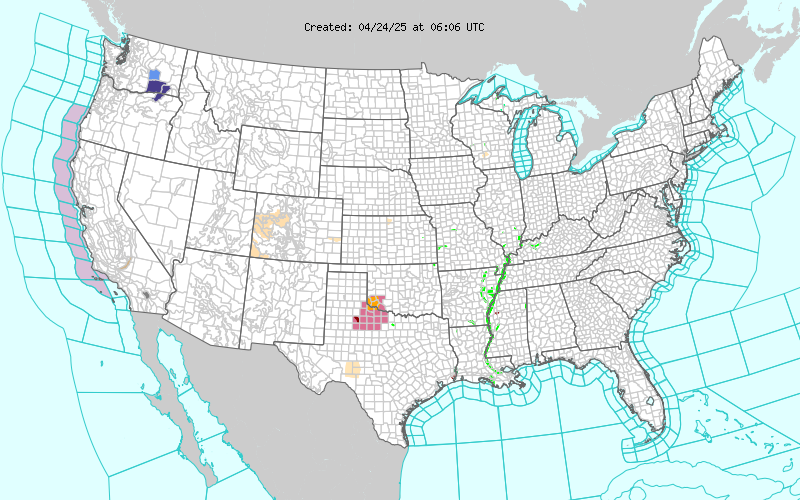
And to see the extent of this system, take a look at the NWS Advisories graphic in the sidebar to the right. Unbelievable how widespread the Warnings are. From Ice Storm Warnings in Texas to Winter Storm Warnings in Northern Maine!
Temperatures in flux
We've had some wild fluctuations in temperatures over the past few weeks across the Northern Plains. While we remained rather cool through a good chunk of December, January has begun rather cold.
An arctic outbreak entrenched much of the central and eastern parts of the country the last two weeks and with a slight moderating the last few days, another shot of cold air seems to be on it's way.
By this time, tomorrow night, we'll likely see temperatures in the double-digits below zero once again here in the Valley with even colder temperatures expected over northern Minnesota. The NAM shown to the left has the H50 heights near 522 over us, with even lower heights to the east and northeast.
So, we'll see another cold, January weekend.
Looking ahead, the GFS doesn't really show much in the way of any major pattern shifts, with several troughs pushing east-southeast out of Western Canada through, at least, the next couple of weeks. February could start out rather cold, as well, with the extended GFS showing this early in the morning on Feb. 3rd:
Yes, that is a 516 isoheight over the northern valley!
By the 7th, however, a decent ridge begins to build over the west and I'm hoping this will slowly translate to the east, bringing moderating temperatures and warmer temperatures. That would certainly be welcome...
Record snows...
And now you all see what kind of life a storm chaser leads during the winter months. I haven't really had much to write about in the last month or so. Some chasers get pumped at winter storms. I do not. Especially, those that affect me. They only reinforce what I already know. That my car doesn't handle the ice and snow at all. ;)
Anyhow, we were affected by a couple of major winter storms here in the Northern Plains the past 30 days and as such, the NWS has officially announced that December 2008 went down in the record books as the snowiest December on record. Both in Grand Forks and Fargo:
Northwest flow early in the month brought several Alberta Clippers to the state, while a pattern shift brought a more westerly flow near mid-month. This brought Ali, the first full-blown blizzard in many years, to Eastern North Dakota. And since, we're back into the northwesterly flow and thusly have experienced clipper after clipper pretty much every other day for the last week and a half. No significant snowfalls really, but each has dropped between 2 to 4 inches. So, yes, we have well over a foot of snowpack out there and that doesn't do anything to help our temperatures.RECORD EVENT REPORT
NATIONAL WEATHER SERVICE EASTERN NORTH DAKOTA/GRAND FORKS
712 PM CST THU JAN 1 2009
...RECORD MONTHLY SNOWFALL AT GRAND FORKS UNIV. (NWS) SITE FOR
DECEMBER 2008...
30.1 INCHES OF SNOWFALL OCCURRED IN DECEMBER 2008 AND THIS IS THE
HIGHEST EVER MONTHLY SNOWFALL FOR DECEMBER. THE ALL TIME MONTHLY
SNOWFALL FOR ANY MONTH IS 31.5 INCHES SET IN JANUARY 1989.
...RECORD MONTHLY SNOWFALL AT FARGO/MOORHEAD FOR DECEMBER 2008 AND
FOR ALL-TIME...
OFFICIALLY 33.5 INCHES OF SNOW FELL IN FARGO/MOORHEAD FOR DECEMBER
2008. THIS WAS THE HIGHEST TOTAL FOR DECEMBER 2008 AND FOR ANY
MONTH. THE PREVIOUS RECORD FOR HIGHEST MONTHLY SNOWFALL FOR ANY
MONTH WAS 31.5 INCHES IN JANUARY 1989.
Yet, today... More impending doom:

We have bright sunshine out there right now, but these clouds heading our way will be bringing more snowfall, potentially 6+ inches, to the area. The NWS Advisories map to the right will show you the winter weather advisories that are in affect across the area.
A great way to start the 2009 year... more snow! :(
Happy New Years, everyone. Hope you all had a great holiday season.
Previously
Twitter Updates
What I'm Reading
-
Farewell to Suomi NPP1 week ago
-
KDOT troubles15 years ago
-
This is the End17 years ago
Chaser / Weather Blogs
Labels
- admin (1)
- advisories (4)
- blizzard (4)
- cold temps (1)
- damaging wind (1)
- digression (1)
- flooding (3)
- forecast (3)
- hail (1)
- ice (2)
- logs (1)
- observations (3)
- outbreak (1)
- philosophy (1)
- radar (1)
- record reports (1)
- severe weather (1)
- snowfall (6)
- storm chasing (1)
- storm reports (2)
- tornadoes (1)
- wcn (1)